Brandfetch's icon's iconAW3D's icon
Banner
AW3D's brand icon

AW3D

@aw3d.jp

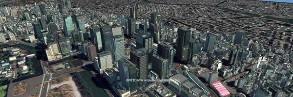
最高50cmの解像度で陸地の起伏を表現する世界最高精度のデジタル3D地図サービス「AW3D」は、宇宙航空研究開発機構(JAXA)や米国DigitalGlobe社の衛星画像を利用し、世界70か国以上・300以上のプロジェクトで活用頂されています。

aw3d.jp

AW3D's Company Logos

AW3D's logos

Logo

PNG

AW3D's logos

Logo

PNG

AW3D's logos

Icon

JPEG

AW3D's logos

Icon

JPEG

AW3D's Brand Colors

Hex Code

Color name

RGB

HSL

CMYK

#4680C2

Steel Blue

70, 128, 194

212, 50, 52

64, 34, 0, 24

#D19E64

Whiskey

209, 158, 100

32, 54, 61

0, 24, 52, 18

#000000

Black

0, 0, 0

0, 0, 0

0, 0, 0, 100

About AW3D

AW3D is a brand that offers the world's most accurate digital 3D maps service. With a resolution of up to 50cm, AW3D uses satellite images from the Japan Aerospace Exploration Agency (JAXA) and DigitalGlobe to accurately represent the elevation of land in over 70 countries and has been utilized in more than 300 projects. AW3D is not only the first digital 3D map in the world to achieve a resolution of 5m, but it can also provide 3D data with a resolution as high as 0.


5m in urban areas. This advanced technology allows for the precise reproduction of even the finest details, from rugged mountainous terrains to individual buildings. AW3D revolutionizes the process of 3D map creation by offering exceptional speed and cost-efficiency, making it ideal for resource development, infrastructure planning, and VR content creation.


Developed in collaboration between RESTEC, a center with expertise in satellite image processing, and NTT Data, renowned for its high-speed and high-precision data processing technology, AW3D combines the best of both worlds. By utilizing JAXA's ALOS satellite and the high-resolution satellite images by Maxar, AW3D provides a comprehensive and globally available 3D map. It overcomes previous challenges, such as high costs and limited coverage, to make 3D maps accessible to a wider audience.


AW3D has been widely adopted in over 130 countries and over 3,000 projects in various fields, such as infrastructure development, disaster management, and climate change response. It has contributed to the efficiency and advancement of fields including disaster prevention, resource exploration, urban planning, power, and communication services, thanks to its wide coverage, high resolution, extensive product lineup, and global support system. AW3D has received prestigious awards, such as the Asia Geospatial Technology Innovation Awards 2017 and the Nikkei Industrial Newspaper Award for Excellence.


With a proven track record, AW3D continues to expand its market reach and is committed to providing comprehensive solutions that integrate with business applications. By combining AW3D's extensive product offerings, such as standard terrain data, high-resolution terrain data, ortho images, building 3D data, telecom 3D data, airport 3D data, and the diverse datasets from Maxar, ICEYE, and Planet, AW3D is the go-to solution for a wide range of applications, from energy and wind power simulation to infrastructure construction and management, dam construction, disaster prevention, public health, map creation, aviation navigation, urban development planning, mineral resource exploration, water resource management, and CG production. AW3D's impact has been recognized by the media, and its achievements have been featured in various publications.


With its cutting-edge technology, broad application, robust product lineup, and strong support system, AW3D is actively contributing to the efficiency and enhancement of various industries worldwide

Read more...

Brand industry

Computers Electronics and Technology

Company type

Partnership

Year founded

2014

Company size

11-50 employees

Related Brands

  1. Explore

  2. 🖥 Computers Electronics and Technology

  3. Computers Electronics and Technology

  4. AW3D

Brandfetch logo
Brandfetch logo

Our mission is to keep every brand on-brand everywhere 👋We're the leading brand data aggregator, simplifying next-level B2B personalization for developers

All services online

SOC2

Top brand categories

📂Browse all categories⭐Browse by featured🏢Browse by industry🌍Browse by region🖥Computers Electronics and Technology🍿Arts and Entertainment💰Finance🍔Food and Drink🏎Vehicles✈️Travel and tourism🛍E-Commerce and Shopping📊Business and Consumer Services📰News and Media🏝Lifestyle💎Luxury💼Jobs and Career🏭Heavy Industry and Engineering🧪Science and Education

For Developers

DevelopersUse casesLogo APIBrand APIBrand Context APIBrand Search APIBrandfetch MCPPricingDocs

Company

HomeFor BrandsPluginsTerms and conditionsPrivacy policyHelp & supportBlogLLMSauth.md

© 2026 Brandfetch, SA. All rights reserved.

Route de la Goille 2, 1073 Savigny, Switzerland

Brandfetch's light symbol

Get a brand page like this

Brandfetch Logo

Overview

Library

Developers / APIList your brand
Banner
AW3D's brand icon

AW3D

Unclaimed brand

最高50cmの解像度で陸地の起伏を表現する世界最高精度のデジタル3D地図サービス「AW3D」は、宇宙航空研究開発機構(JAXA)や米国DigitalGlobe社の衛星画像を利用し、世界70か国以上・300以上のプロジェクトで活用頂されています。

aw3d.jp

Liking this brand profile? Share this page

For developers

Build with Brand data

Fetch logos, colors, fonts, and company details for 50M+ brands.

AI Workflow

Connect to Brandfetch MCP

Bring brand data into Claude, Cursor, and any other AI assistant.

AW3D's Company Logos

AW3D's logos

Logo

PNG

AW3D's logos

Logo

PNG

AW3D's logos

Icon

JPEG

AW3D's logos

Icon

JPEG

AW3D's Brand Colors

Hex Code

Color name

RGB

HSL

CMYK

#4680C2

Steel Blue

70, 128, 194

212, 50, 52

64, 34, 0, 24

#D19E64

Whiskey

209, 158, 100

32, 54, 61

0, 24, 52, 18

#000000

Black

0, 0, 0

0, 0, 0

0, 0, 0, 100

About AW3D

AW3D is a brand that offers the world's most accurate digital 3D maps service. With a resolution of up to 50cm, AW3D uses satellite images from the Japan Aerospace Exploration Agency (JAXA) and DigitalGlobe to accurately represent the elevation of land in over 70 countries and has been utilized in more than 300 projects. AW3D is not only the first digital 3D map in the world to achieve a resolution of 5m, but it can also provide 3D data with a resolution as high as 0.


5m in urban areas. This advanced technology allows for the precise reproduction of even the finest details, from rugged mountainous terrains to individual buildings. AW3D revolutionizes the process of 3D map creation by offering exceptional speed and cost-efficiency, making it ideal for resource development, infrastructure planning, and VR content creation.


Developed in collaboration between RESTEC, a center with expertise in satellite image processing, and NTT Data, renowned for its high-speed and high-precision data processing technology, AW3D combines the best of both worlds. By utilizing JAXA's ALOS satellite and the high-resolution satellite images by Maxar, AW3D provides a comprehensive and globally available 3D map. It overcomes previous challenges, such as high costs and limited coverage, to make 3D maps accessible to a wider audience.


AW3D has been widely adopted in over 130 countries and over 3,000 projects in various fields, such as infrastructure development, disaster management, and climate change response. It has contributed to the efficiency and advancement of fields including disaster prevention, resource exploration, urban planning, power, and communication services, thanks to its wide coverage, high resolution, extensive product lineup, and global support system. AW3D has received prestigious awards, such as the Asia Geospatial Technology Innovation Awards 2017 and the Nikkei Industrial Newspaper Award for Excellence.


With a proven track record, AW3D continues to expand its market reach and is committed to providing comprehensive solutions that integrate with business applications. By combining AW3D's extensive product offerings, such as standard terrain data, high-resolution terrain data, ortho images, building 3D data, telecom 3D data, airport 3D data, and the diverse datasets from Maxar, ICEYE, and Planet, AW3D is the go-to solution for a wide range of applications, from energy and wind power simulation to infrastructure construction and management, dam construction, disaster prevention, public health, map creation, aviation navigation, urban development planning, mineral resource exploration, water resource management, and CG production. AW3D's impact has been recognized by the media, and its achievements have been featured in various publications.


With its cutting-edge technology, broad application, robust product lineup, and strong support system, AW3D is actively contributing to the efficiency and enhancement of various industries worldwide

Read more...

Brand industry

Computers Electronics and Technology

Company type

Partnership

Year founded

2014

Company size

11-50 employees
Related Brands

  1. Explore

  2. 🖥 Computers Electronics and Technology

  3. Computers Electronics and Technology

  4. AW3D

Brandfetch logo
Brandfetch logo

Our mission is to keep every brand on-brand everywhere 👋We're the leading brand data aggregator, simplifying next-level B2B personalization for developers

All services online

SOC2

Top brand categories

📂Browse all categories⭐Browse by featured🏢Browse by industry🌍Browse by region🖥Computers Electronics and Technology🍿Arts and Entertainment💰Finance🍔Food and Drink🏎Vehicles✈️Travel and tourism🛍E-Commerce and Shopping📊Business and Consumer Services📰News and Media🏝Lifestyle💎Luxury💼Jobs and Career🏭Heavy Industry and Engineering🧪Science and Education

For Developers

DevelopersUse casesLogo APIBrand APIBrand Context APIBrand Search APIBrandfetch MCPPricingDocs

Company

HomeFor BrandsPluginsTerms and conditionsPrivacy policyHelp & supportBlogLLMSauth.md

© 2026 Brandfetch, SA. All rights reserved.

Route de la Goille 2, 1073 Savigny, Switzerland