CheckTerra s.r.o.
@checkterra.cz
#Geoinformatics. #Photogrammetry. #GIS. #Geodesy. #Consultation. #drones #lidar #landsurveying #GPS #GNSS #gopro
CheckTerra s.r.o.'s Company Logos

CheckTerra s.r.o.'s Brand Colors
Hex Code
Color name
RGB
HSL
CMYK
#83B81A
Lima
131, 184, 26
80, 75, 41
29, 0, 86, 28
#FFFFFF
White
255, 255, 255
0, 0, 100
0, 0, 0, 0
#222222
Mine Shaft
34, 34, 34
0, 0, 13
0, 0, 0, 87
About CheckTerra s.r.o.
CheckTerra s. r. o.
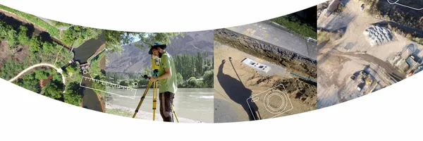
With a team of highly skilled professionals boasting over two decades of experience, CheckTerra is committed to collecting and processing data using cutting-edge technologies like unmanned aerial vehicles (drones), laser scanning, mobile mapping systems, and digital photogrammetry. They also employ traditional geodetic methods such as total station surveying and GNSS. Their wide range of services includes real estate cadastre, engineering geodesy, GIS, and expert advice.
CheckTerra's expertise extends globally, as they have successfully executed projects worldwide (check their references for more details). As trusted authorities in land surveying and real estate cadastre, their employees possess in-depth knowledge of relevant regulations and have experience dealing with state administrative authorities. What sets CheckTerra apart is their commitment to understanding their clients' motivations and needs.
By doing so, they offer tailored solutions and ensure the most effective use of the acquired data. CheckTerra s. r.
o. For more information, visit their website at www. checkterra.
cz
Company type
Privately Held
Year founded
2013
Company size
2-10 employees