Firemap
@firemap.pt
FIREMAP - Mapping our World
Firemap's Company Logos

Firemap's Brand Colors
Hex Code
Color name
RGB
HSL
CMYK
#FF5E1F
Orange
255, 94, 31
17, 100, 56
0, 63, 88, 0
#FFFFFF
White
255, 255, 255
0, 0, 100
0, 0, 0, 0
#202020
Mine Shaft
32, 32, 32
0, 0, 13
0, 0, 0, 87
About Firemap
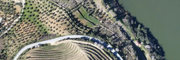
Firemap is a leading brand in the field of engineering services for geographic information acquisition and processing. Our expertise lies in the development of advanced aerial surveying services using remotely piloted aircraft (RPA), RGB and multispectral sensors, LIDAR, GPS/GNSS, and total stations. Since our establishment in 2013, we have been dedicated to research, development, and innovation, continuously providing new solutions to our clients.
Our goal is to become a benchmark in the markets we operate. We offer a wide range of services in sectors such as land planning, energy, construction, infrastructure, agriculture, and forestry. Our products include high-precision LIDAR surveys, large-scale vector mapping through photogrammetric processes, high-resolution georeferenced orthophotomaps, accurate topographic surveys using classic geoengineering equipment and drone-based sensors, and vegetation indices derived from multispectral sensors.
With a portfolio of completed projects and expertise in innovation, Firemap is ready to assist you. Contact us today to leverage our expertise in geographic information engineering
Brand industry
Heavy Industry and Engineering
Company type
Privately Held
Year founded
2013
Company size
2-10 employees