
Unclaimed brand
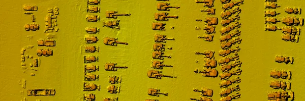
Maps Made Easy is a web application that lets users upload aerial photos, stitch the images and host created maps. Creating maps with your DJI drones (and other many others) has never been easier.
Liking this brand profile? Share this page

Hex Code
Color name
RGB
HSL
CMYK
#F69222
Tree Poppy
246, 146, 34
32, 92, 55
0, 41, 86, 4
#F4F4F4
Wild Sand
244, 244, 244
0, 0, 96
0, 0, 0, 4
#222222
Mine Shaft
34, 34, 34
0, 0, 13
0, 0, 0, 87
Maps Made Easy is a web application that provides users with an effortless way to create maps using aerial photos. Designed for DJI drones and other similar devices, this platform allows users to upload their images, stitch them together, and host the resulting maps. Whether you need orthophoto maps, 3D models, or digital surface models, Maps Made Easy has you covered.
The service offers flexible payment options, with both pay-as-you-go and subscription plans available. Small jobs even receive unlimited free processing. Users have complete control over the quality and timing of their maps, ensuring they have the level of detail they require.
In addition, Maps Made Easy allows users to measure objects, monitor crops, and share their creations via links or on social media. With standard formats and compatibility with existing GIS solutions, Maps Made Easy is the go-to solution for all your mapping needs
Brand industry
Computers Electronics and Technology
Company type
Suggest company type
Year founded
Suggest founded year
Company size
Suggest company size
