MSDI
@msdi.co.id
3D mapping drone services in Indonesia, LiDAR Survey, Topography, Photogrammetry, Assets inspection, Oil & GAS, Mining, Archaeology, Civil Engineering, Forest
MSDI's Company Logos

MSDI's Brand Colors
Hex Code
Color name
RGB
HSL
CMYK
#FDC502
Supernova
253, 197, 2
47, 98, 50
0, 22, 99, 1
#FFFFFF
White
255, 255, 255
0, 0, 100
0, 0, 0, 0
#8AA103
Limeade
138, 161, 3
69, 96, 32
14, 0, 98, 37
About MSDI
MSDI is a high-end drone mapping brand that offers top-of-the-line services in Indonesia. They specialize in 3D mapping using cutting-edge technology such as LiDAR survey, photogrammetry, and high accuracy topography. With their expertise in various industries like civil engineering, oil & gas, mining, archaeology, and forestry, MSDI provides comprehensive solutions for aerial survey and mapping.
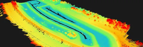
By utilizing advanced drones equipped with RTK technology, MSDI ensures centimeter-level accuracy in their mapping projects. LiDAR mapping is particularly advantageous as it allows them to penetrate vegetation and deliver precise results, even up to 5 layers of foliage with 0. 5 cm accuracy.
MSDI takes pride in their team of professional engineers and licensed drone operators who guarantee the best results for every project. With quick response times, fast delivery, and international insurance coverage, MSDI ensures a seamless experience for their clients. They also showcase their expertise with the arrival of new advanced sensors and drones, enabling them to push the limits of efficiency further.
MSDI serves not only in Indonesia but also in neighboring countries, providing mapping services in major cities and remote areas alike. Choosing MSDI for drone mapping services offers numerous advantages. Compared to conventional surveys, drone surveys are cost-effective, faster, and provide more detailed results.
They also ensure safety, especially for missions that involve risky or inaccessible areas. At MSDI, they take pride in their capabilities, offering smart real-time monitoring, the ability to penetrate dense vegetation, impressive target echoes, and centimeter accuracy. With compatibility with various GIS software, clients can expect tailored solutions for their mapping needs.
For those in need of asset inspection, monitoring, survey, or inspection, MSDI offers comprehensive packages starting from IDR 2 million. Their drone mapping packages ensure both low and high accuracy photogrammetry, including aerial photos, videos, and 2D/3D mapping, catering to various needs and budgets. MSDI is your go-to brand for high-quality, reliable, and efficient drone mapping services in Indonesia and beyond
Brand industry
Computers Electronics and Technology
Company type
Privately Held
Year founded
2019
Company size
11-50 employees